
Cart is empty


Lightly X Tiny X Friendly Design X WaterPoor
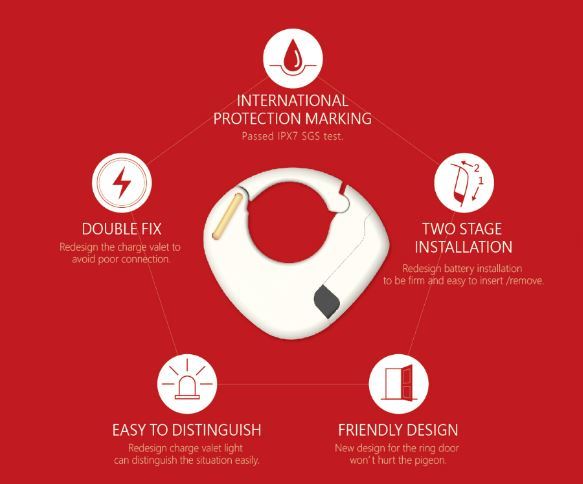
Passed IPX7 SGS test X Strengthened Ring Door X International Certifications
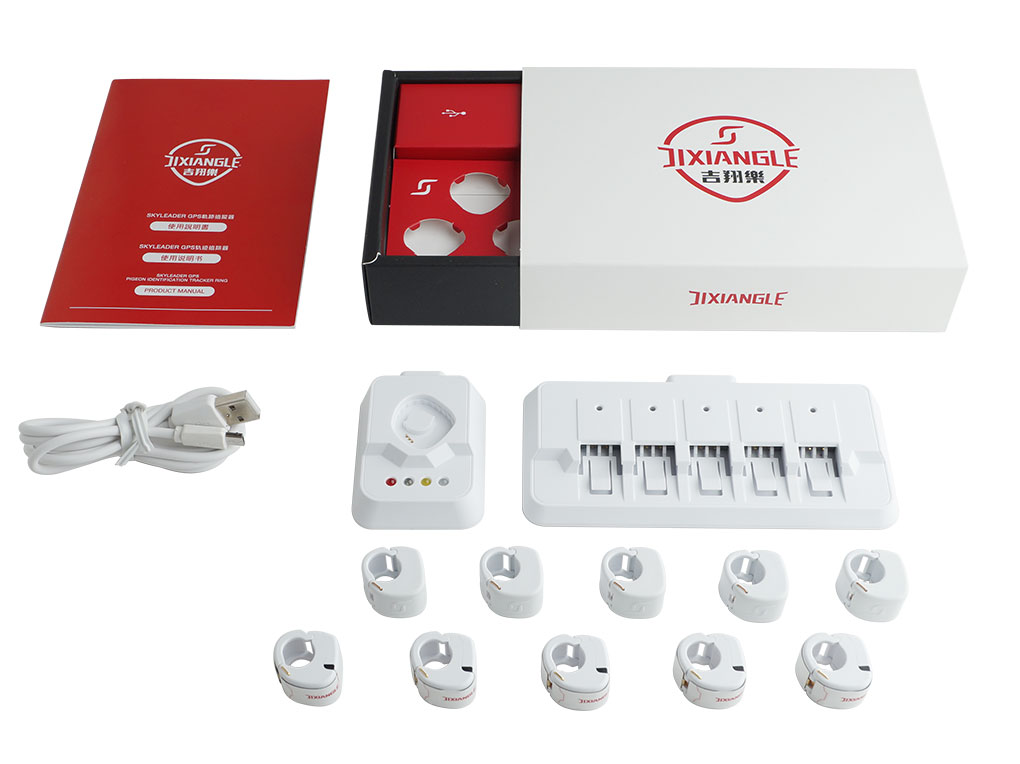
- What's In Box
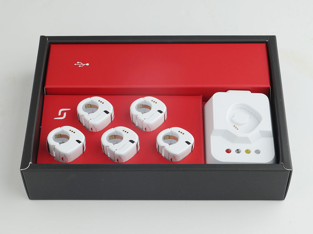
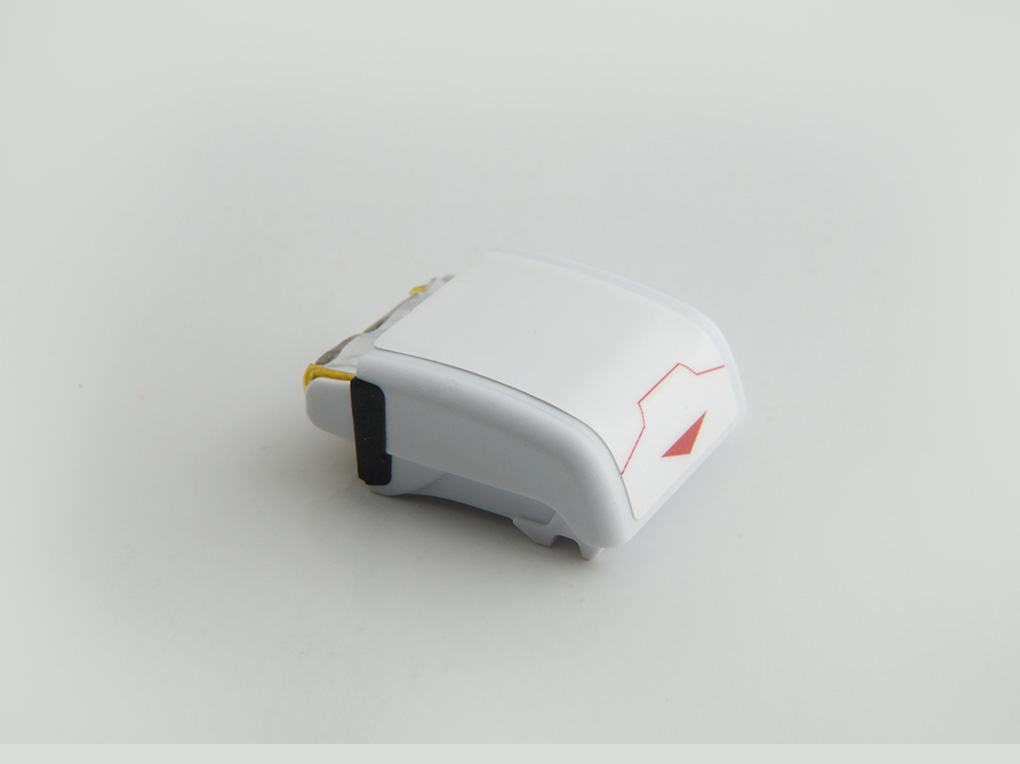
- GPS Ring x 5
- Dummy Ring x 5
- Battery x 5
- Ring Reader x 1
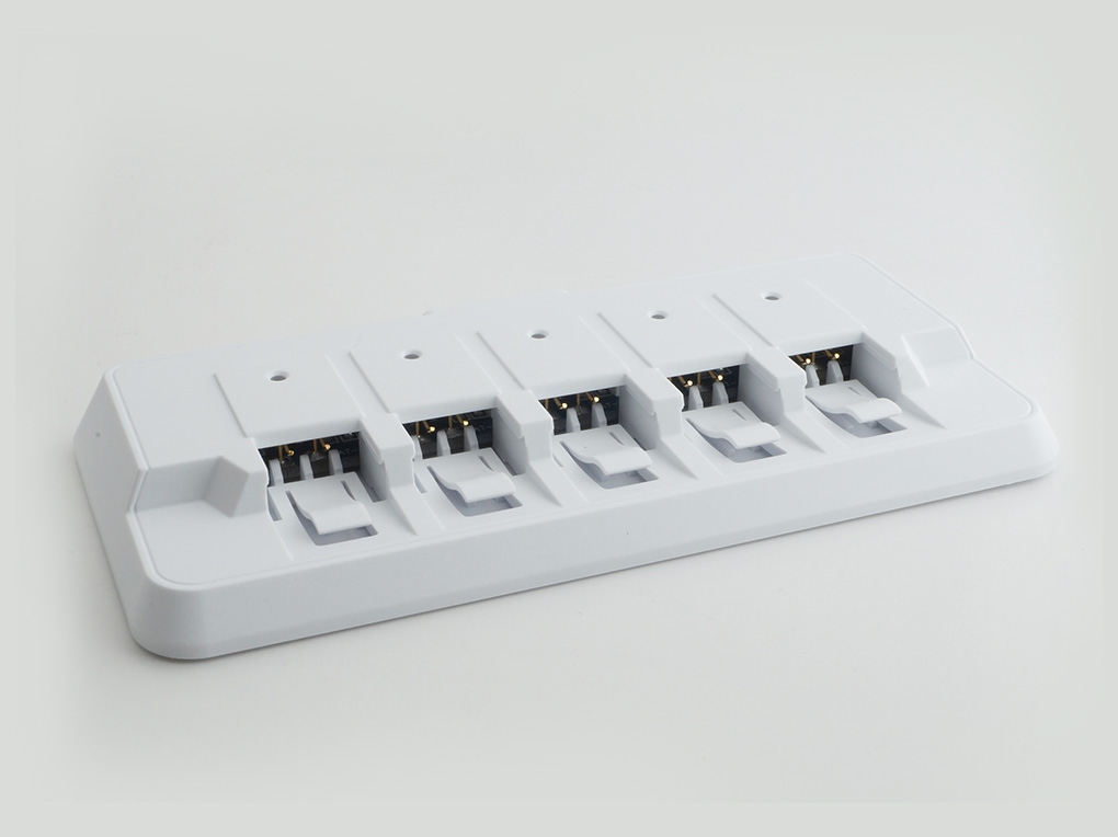
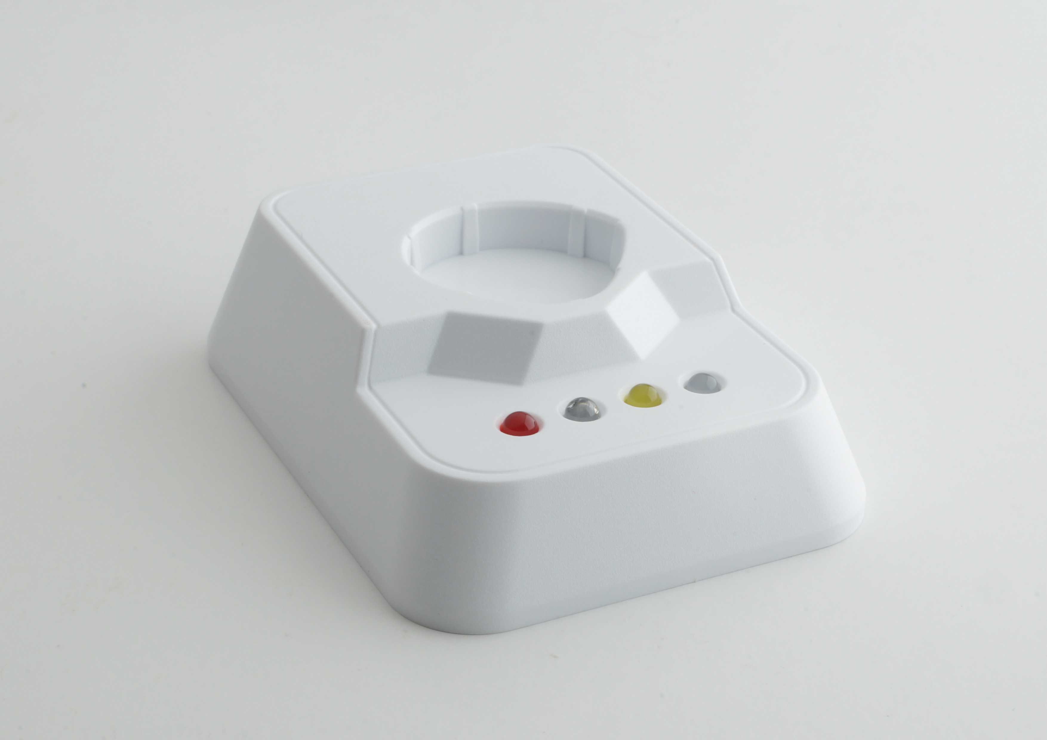
- Charg Valet x 1
- USB Cable x 1
- Manual x 1
- GPS Specifications
- For the pigeon’s ring is smaller than 12.2mm
- Box Dimensions - 22 x 16 x 13cm
- Weight – 500g
- Battery Type - Rechargeable Lithium Battery 3.7V 45mAh
- Battery Life - 12 hours
- Voltage - +2.9 to +4.2v
- Satellite System - GPS + GLONASS Dual-core System
- Features
- Jixiangle Skyleader GPS tracker ring to make pigeon training scientifically, it also records the digitalized data to the cloud. Pigeon fancier can understand of the actual flight situations of pigeons.
- Contain:5 GPS rings (Batteries Included), 5 dummy rings,1 ring reader, 1charge valet, 1 USB cable and 1 user manual.
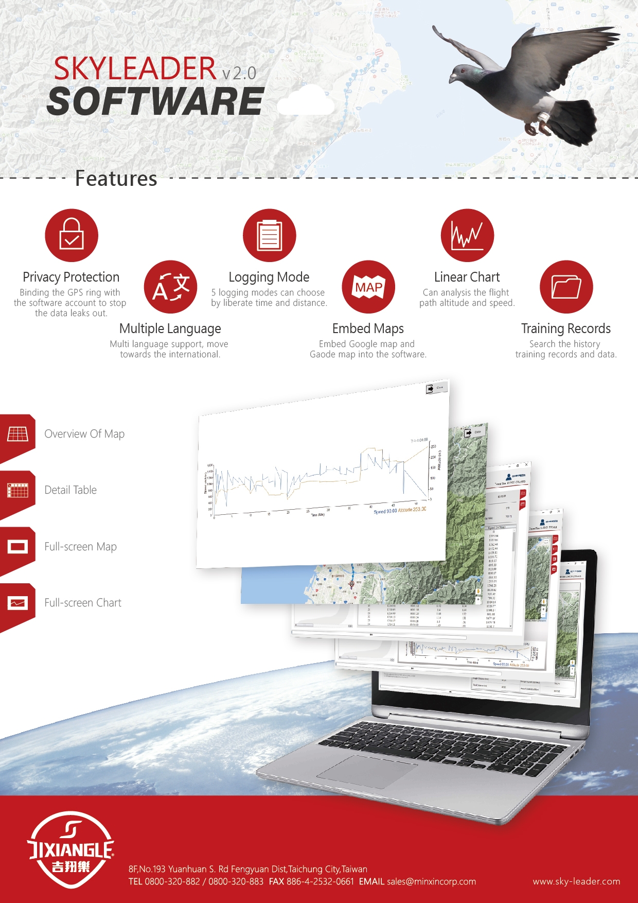
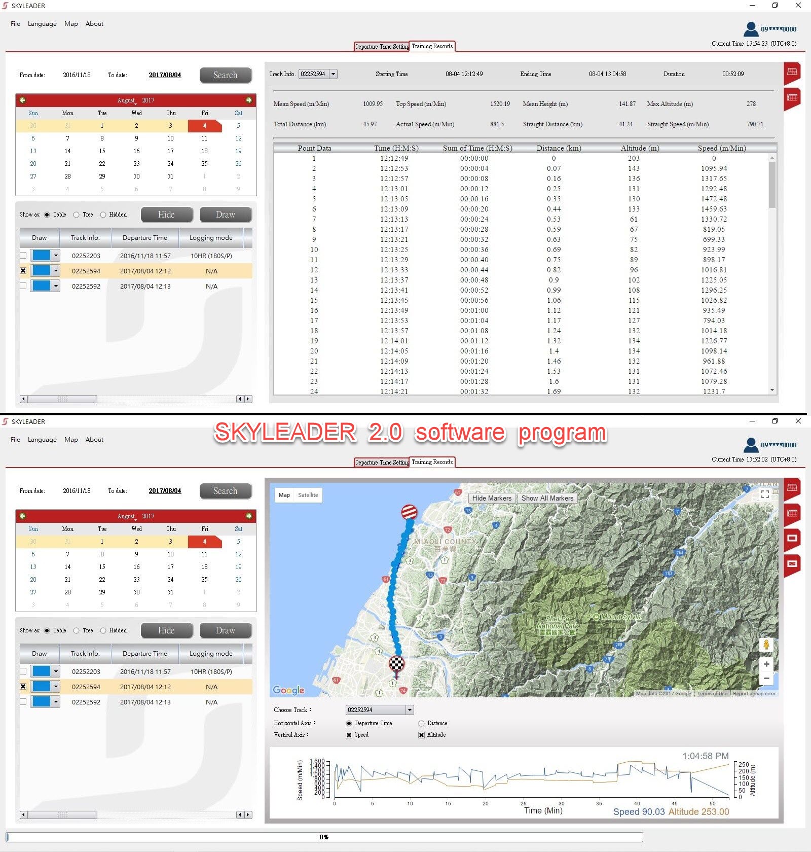
- Download free software with privacy protection and multiple languages. It can work on Win 7, Win 8, Win 10 and Mac (Minimum system requirements-macOS Sierra).
- Friendly Design that won’t hurt the pigeon. Waterproof and Passed IPX7 SGS test.
- Innovative products developed and manufactured in Taiwan. During the pandemic, the order is shipping as usual. Delivery dates depend on the flight and the process of clearance of goods.
- Two-Stage Installation: Redesign battery installation to be firm and easy to insert /remove.
- Strengthened Ring Door: The tightness of ring door increase by 400% won’t come off easily.
- Easy To Distinguish: Redesign charge valet light can distinguish the situation easily.
- Double Fix: Redesign the charging valet to avoid poor connection.
- Certification
- UL Certification
- CE Certification
- FCC Certification
- Software
- Multiple Language: Multi-language support, move towards the international.
- Embed Maps: Embed Google map and Gaode map into the software.
- Linear Chart: Can analysis the flight path altitude and speed.
- Training Records: Search history training records and data.
- Battery
- Guarantee to keep the battery in good repair in 6 months from the shipment.
The import duties, taxes and charges are not included in the item price or shipping charges. These charges are the customer’s responsibility.
No posts found
Battery Precautions and Safety Instructions
Lithium-ion Polymer Battery
Please be sure to take to comply with the specifications and the following precautions to use with batteries, did not follow the specifications for the operation caused any accidents, will not accept any responsibility.
- Guarantee to keep the battery in good repair in 6 months from the shipment.
- Please use 0.5C current to charge up 60 % capacity after the battery placed 3 months.
- Need to use the original battery charger and should be placed in a dry ventilated place.
- Such as long-term when not in use, the battery charger to change state half full, remove the battery from the device and separated, to avoid metal contact with the battery, causing short-circuit or damage to the phenomenon.
- Suggestion:
(1)Charge the battery when the GPS ring return.
(2)Storing the battery in a cool and dry place.
(3)If you didn’t use it for the long term, charge it in every 3 weeks. There is an easy way to go, just install to the GPS ring and leave it about half-day, then remove and charge again.
(4)Before you are going to release, charge it >> set up the departure time >> release. - In use or during storage, battery found there has been high fever, leakage, odor, distortion and other anomalies, please stop using it immediately and stay away from the battery.
- Do not short-circuit the battery positive and negative, and careful not to allow the battery to moisture, to avoid danger.
- Using, keep away from heat, Hing pressure place, and do not beat, hit the battery.
- Battery end of life should be immediately remove from the equipment. Please properly handle security of spent batteries, do not put into fire or water.
- Environmental conditions, not cycling alone, govern the longevity of lithium-ion batteries. The worst situation is keeping a fully charged battery at elevated temperatures. Battery packs do not die suddenly, but the runtime gradually shortens as the capacity fades.
- The ideal storage temperature is 22°C - 28°C. Never store the battery in environments with a temperature higher than 60°C (140°F).
- The battery will only charge when the temperature is between 0° (32°) and 45°C (113°F) and should be used in temperatures from -20°C to 60°C.
- Do not leave the device exposed to a heat source or in a high temperature location, such as in the sun in an unattended vehicle. To prevent the possibility of damage, remove the device from the vehicle or store it out of direct sunlight, such as in the glove box.
- Do not use a sharp object to remove the removable batteries.
- Do not remove or attempt to remove the non-user-replaceable battery.
- Only replace batteries with correct replacement batteries. Using other batteries presents a risk of fire or explosion. To purchase replacement batteries, see the JIXIANGLE website.
- Use a wet tissue to clean the ring reader probe for keep in good working order.
- Do not remove the battery after set the departure time.
